1:250 Interactive Site &
Surface Model
MODEL NUMBERS 2 & 3: 2012-2013
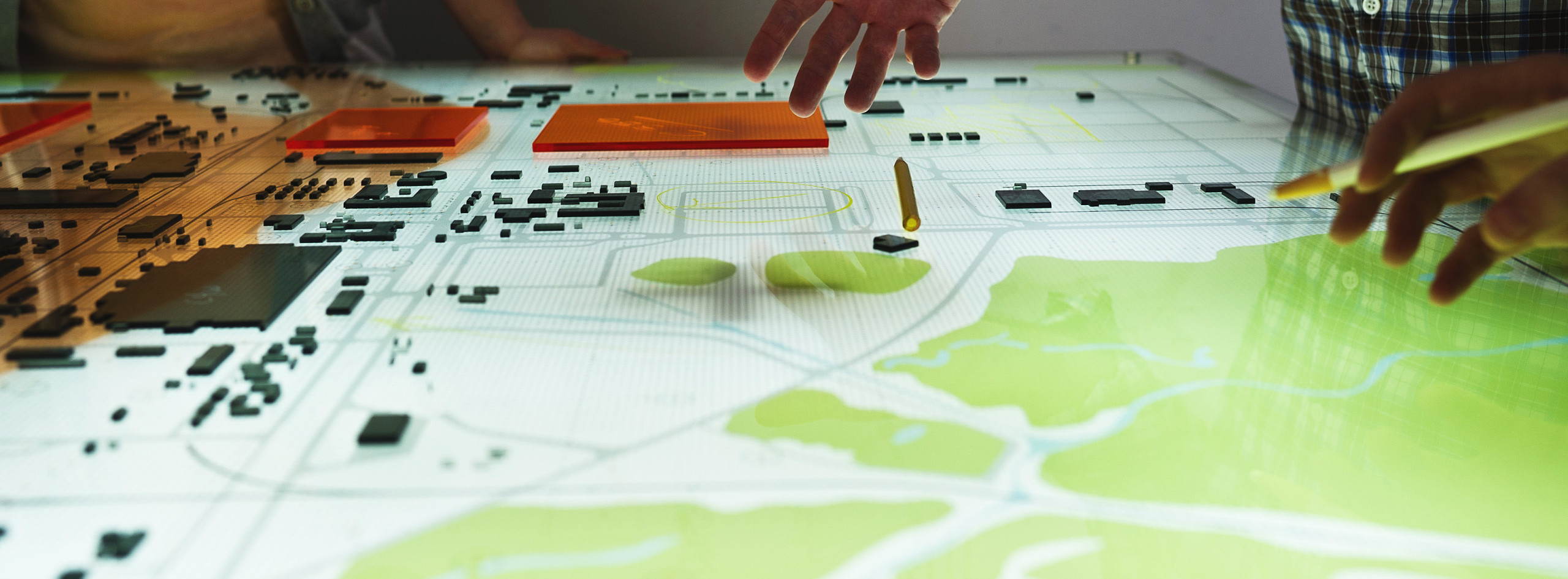
Using multiple layers of backlit acrylic, this model of the Paducah Gaseous Diffusion Plan provided a record of borings and monitoring wells alongside the boundaries of the underground contaminant plume. We also documented the site surface conditions, like landscape, buildings & roads. To accompany the model, we designed a toolkit of markers and writing implements, so that PGDP stakeholders could use the model as a tool for communication, and a means of proposing strategies and documenting remediation progress.

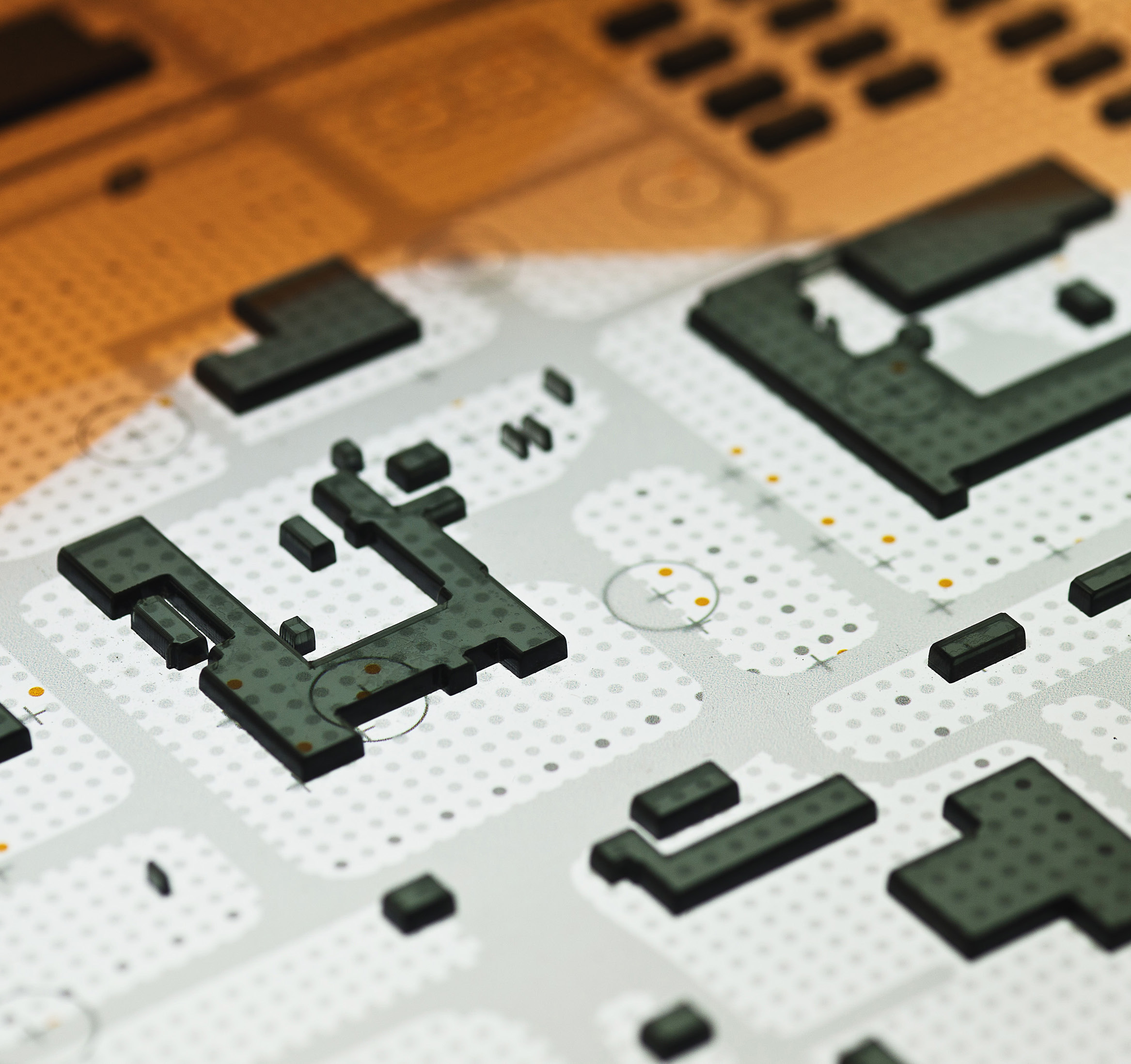
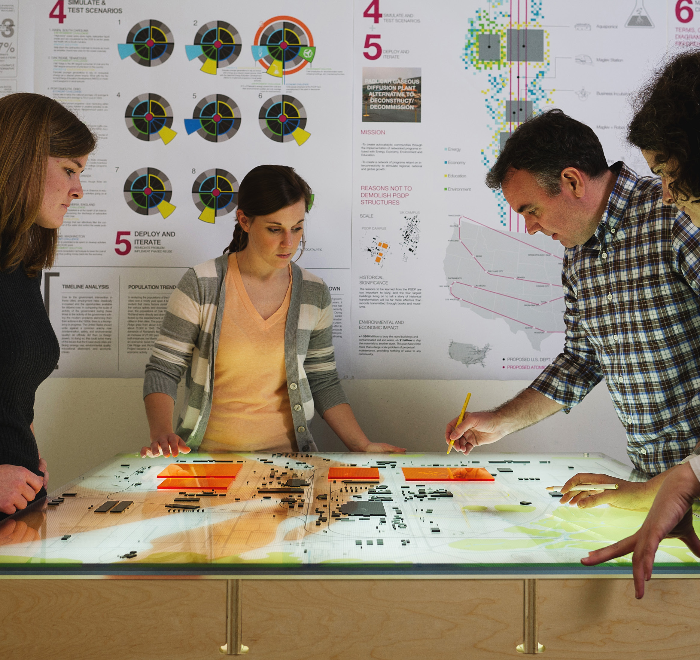
The team used digitally printed acrylic, laser-cut acrylic, LED strips, and a plywood base. Like earlier models, each layer can be dismantled and updated as new data becomes available. We compiled data provided from KRCEE and CAER to include borings and monitoring wells with mapping information for the contaminated groundwater concentration boundary. Roads, geographical data, grid and other information are printed onto the acrylic layers to be switched out as data is updated. We designed a toolkit with china markers, game pieces, and scales to accompany the model, in order to enable DOE scientists, staff, and contractors to mark and communicate tasks, scope, and potential scenarios on the site.
PROJECT TEAM
INSTRUCTOR / Co-PI:
Associate Prof. Gary Rohrbacher
Co-PI:
Associate Prof. Anne Filson
LEAD RESEARCH ASSISTANTS:
Carolyn Parrish
Sydney Kidd