
1:350 Geological Model
MODEL NUMBER 1: SUMMER 2012
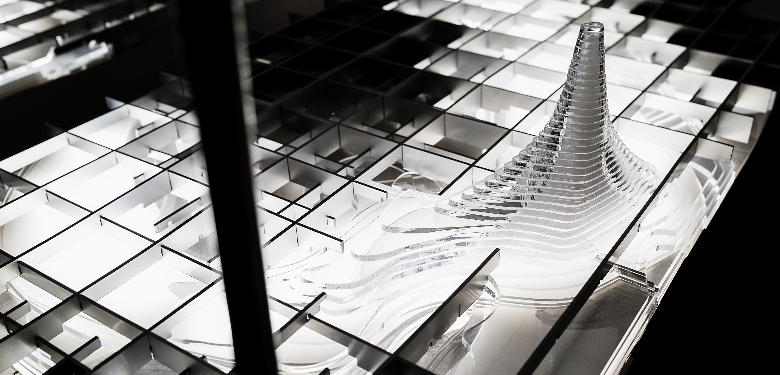
This large-scale architectural model communicated surface and subsurface conditions of the Paducah Gaseous Diffusion Plant site in ways that had yet to be seen. Using architectural model building techniques, we designed a mutable, interactive model for DOE’s stakeholders to understand the site’s complexity, and to use during discussions. This four-part model is comprised of digitally fabricated layers of different materials, based on a 3D CAD model. The model can be dismantled and rebuilt, so that as new data comes available, the DOE can fabricate updated layers, and evolve the model.

As a follow-up to the Atomic Cities design research on the PGDP site, the US Department of Energy, through KRCEE & CAER, funded a series of models to communicate the enrichment plant’s complex, contaminated site conditions.
This first model was designed to communicate the relationship between the underground contaminant plume, groundwater, subsurface geological formations, and the PGDP site. The model was intended for use by scientists, DOE staff, community, contractors, and policymakers to understand a plume that had previously illustrated by coordinates on a spreadsheet.
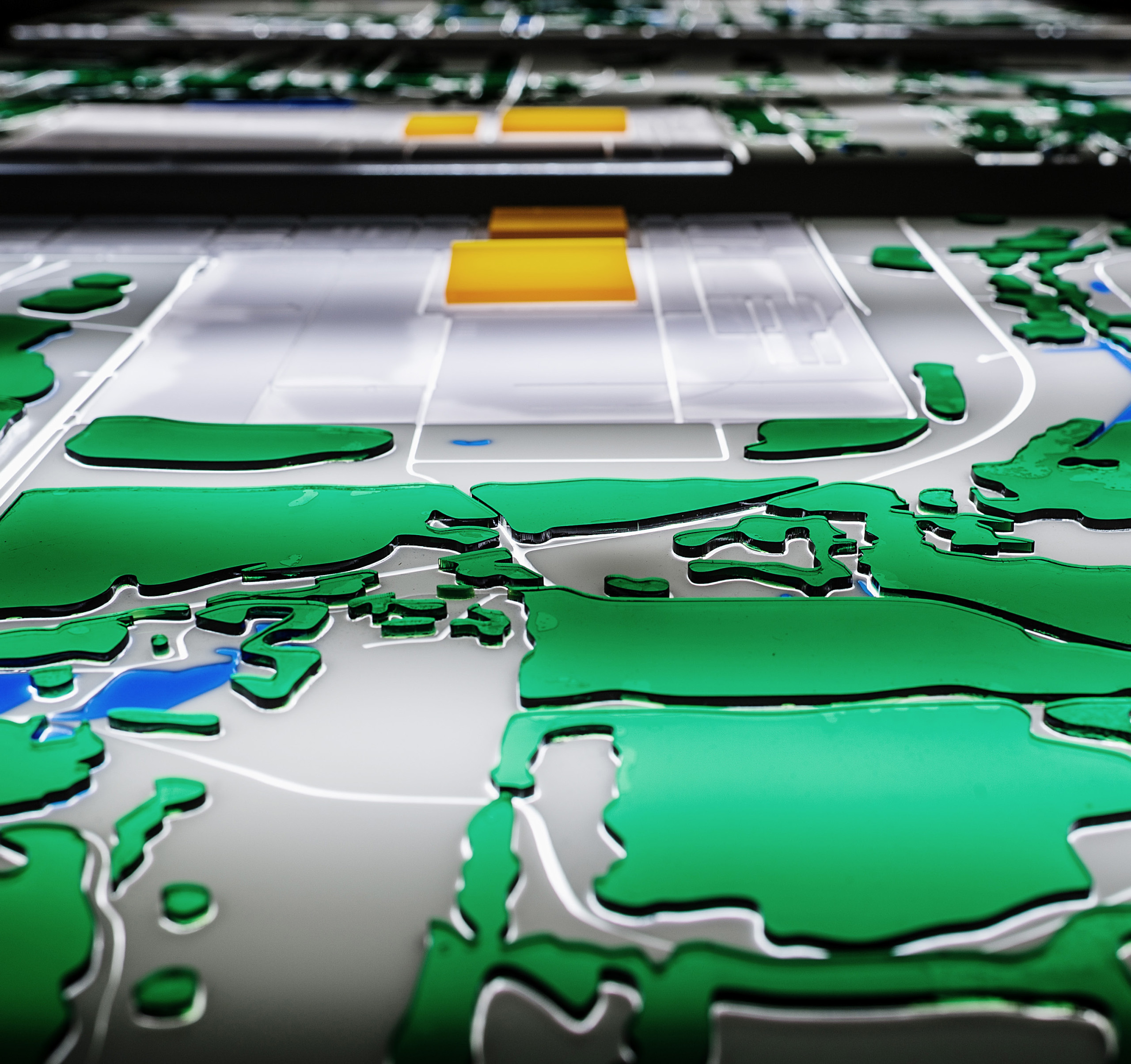
The research team designed, fabricated and delivered the entire model within 4 months. Using different materials and digital fabrication techniques, we designed each individual layers communicated the site’s geological strata, aquifer, Ohio River, contaminated groundwater concentrations, and surface conditions like landscape, buildings & roads.
The materials and construction of each layer involved waterjetted aluminum, lasercut acrylic, digitally contoured polyurethane foam, and a plywood base. As new data becomes available, we can model and fabricate model layers, and insert them into the model. After several successful rounds of public and internal meetings with our first model, the DOE commissioned additional models with increasingly specific site information and greater interactivity. All models show the property in relation to the rural landscape and Ohio River, as well as the underground geological strata, multi-layered aquifer, groundwater contamination, and monitoring wells. This 3D presentation facilitated multi-disciplinary discussions between scientists, agency contractors, policy-makers and the public. Digital fabrication enabled us to make every model an interactive and mutable tool, for stakeholders to record and update throughout the remediation process.
PROJECT TEAM
INSTRUCTOR / Co-PI:
Associate Prof. Gary Rohrbacher
Co-PI:
Associate Prof. Anne Filson
LEAD RESEARCH ASSISTANTS:
Carolyn Parrish
Sydney Kidd
Joseph O’Toole